
The Best View of Rio de Janeiro is the One Nobody Queues For
Some cities make you work for a photograph. You walk for hours, you wait for light that never quite arrives, and you go home with a memory card full of near misses. Rio de Janeiro is the opposite problem as the city hands you so much material that the difficulty becomes choosing where to point the camera, and that question had been rattling around my head long before I landed there in August 2026.
The geography is absurd when you actually see it in person. Granite peaks drop straight into the Atlantic and the forest climbs up the back of residential streets. Beaches curve for kilometres between headlands, and the city has filled in every gap it could find between the two. There is no single angle that contains all of it, which is precisely why I spent a chunk of the trip trying to find the closest thing.
I ended up with four locations. One of them surprised me, and it was not the one on the postcards.
Copacabana beach, just after seven in the morning
I must start by caveating that Copacabana is not a viewpoint. You are at sea level, the buildings sit behind you in a solid wall, and there is no chance of fitting the city into a single frame. What you get instead is the texture of the place, which turns out to be worth more than another wide shot of the skyline.
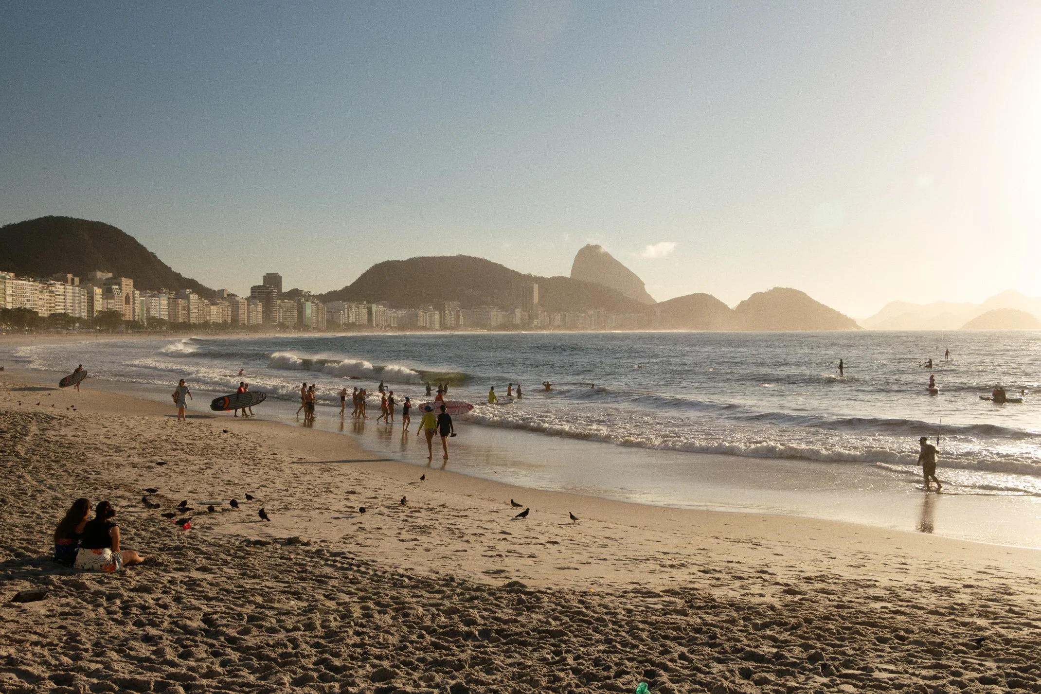
The beach runs for roughly four kilometres between Leme at one end and the Copacabana fort at the other, and the whole stretch wakes up early. By 7am the temperature is still reasonable, and the sand belongs to people who actually live here. Runners, swimmers, football and footvolley games that look far too competitive for that hour, older cariocas working through stretching routines with the sea behind them, and vendors dragging their crates and umbrellas into position and set up for the day ahead. Nobody is performing for a camera, because there is nothing unusual happening. It is just a normal Tuesday.
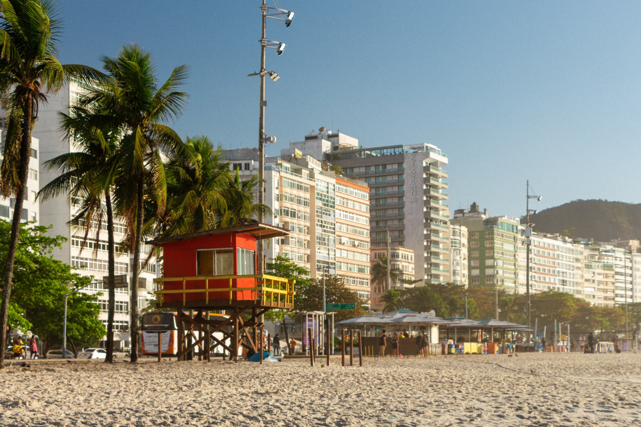
For colour, I have rarely photographed anywhere better. You have the blue of the water, the pale wash of the sand, the black and white waves of the Portuguese pavement running the length of the promenade, dark green forest on the hills, and then the reds, ochres and faded pastels of the buildings behind. Everything sits in the frame at once without any of it fighting. Some of my favourite images from the whole trip came from that early walk, and none of them show more than a fraction of the city.
If you want to understand why Rio became famous in the first place, start here rather than at altitude.
Sugarloaf Mountain, and the twenty minutes before sunset
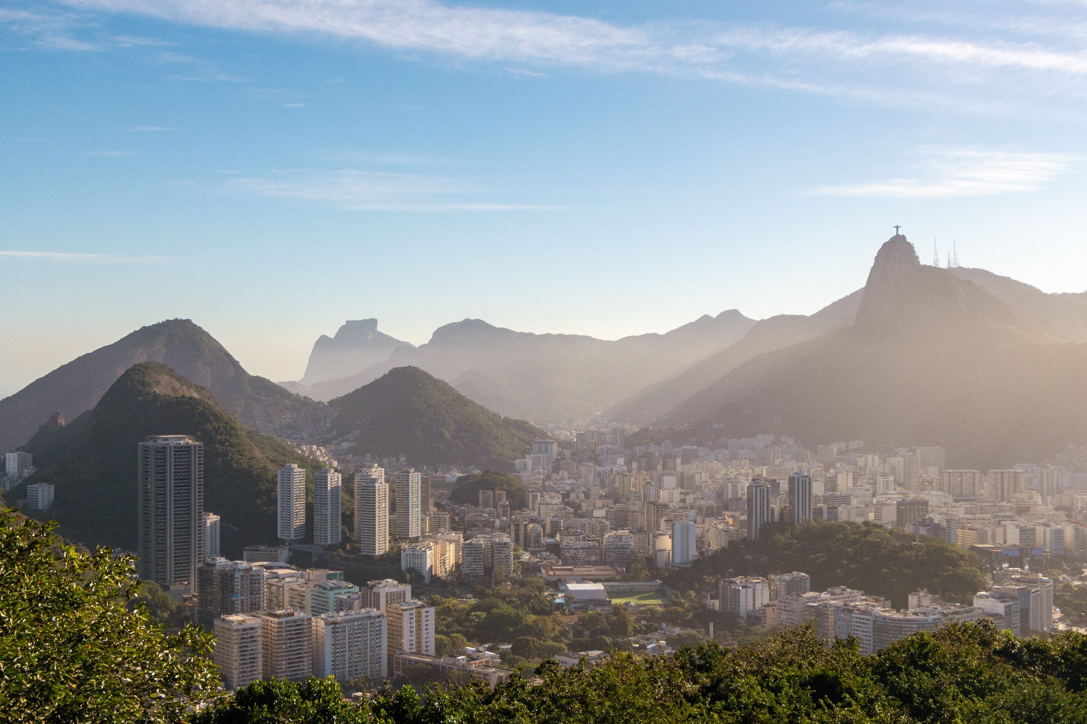
Pão de Açúcar is the classic. A 396 metre lump of granite at the mouth of Guanabara Bay, reached by a cable car that has been running since 1912 and still stops halfway up at Morro da Urca. From the top you are looking back west across Botafogo, the bay, and the ridgeline that carries Christ the Redeemer. If you want the shot of the city with the statue in it, this is where you go.
I need to be realistic about the conditions, though. Sunset is the busiest slot of the day by a distance, and the good side of the summit becomes a wall of raised phones several people deep. I ended up standing on a bench to shoot over the crowd, which worked well right up until a member of staff politely explained that it would not be continuing. Worth it for the two frames I got before that.
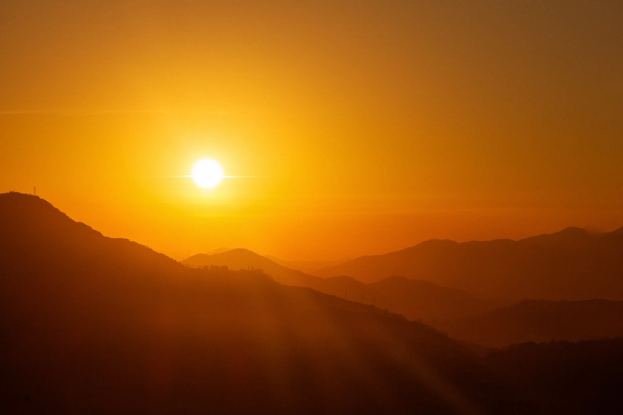
Here is the thing nobody tells you: the sunset itself was not the moment. It was the half hour beforehand. As the sun drops towards the Tijuca ridge, the light starts pushing through the gaps between the peaks and spilling across the city in long shafts. Whole neighbourhoods light up while the ones next door stay in shadow, and it shifts every couple of minutes. I have photographed a lot of golden hours in a lot of places and I cannot think of another city where the terrain slices the light up like that. Get up there early, take the wide shot of Corcovado while you can still see detail in the shadows, and stop worrying about the sun actually going down.
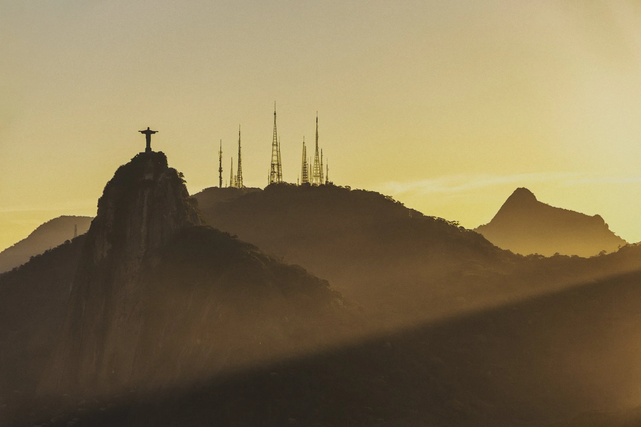
Christ the Redeemer, looking the other way
Corcovado sits at the opposite end of the city from Sugarloaf, 710 metres up inside Tijuca National Park, and it does the reverse job. Here you are shooting back east, with Pão de Açúcar as the object in the distance rather than the platform you are standing on. It was the highest point I got to on this trip, and it gives you the clearest read on how Rio actually works as a city.
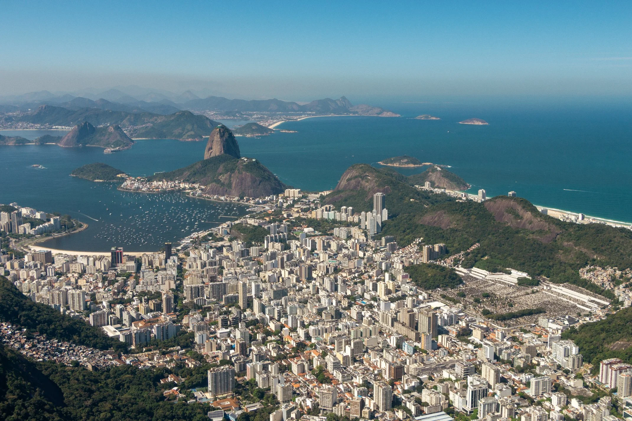
From up there you can trace the whole thing. Lagoa Rodrigo de Freitas sits in the middle like a hole punched through the urban sprawl, ringed by apartment blocks, with Ipanema and Leblon squeezed into the strip between the water and the sea. The mountains push the neighbourhoods apart. Tunnels stitch them back together. Offshore you can pick out the Cagarras islands, and beyond the bay, Niterói. Rio did not spread outwards in a circle the way most cities do. It grew into the gaps it was allowed, and you only really see that from height.
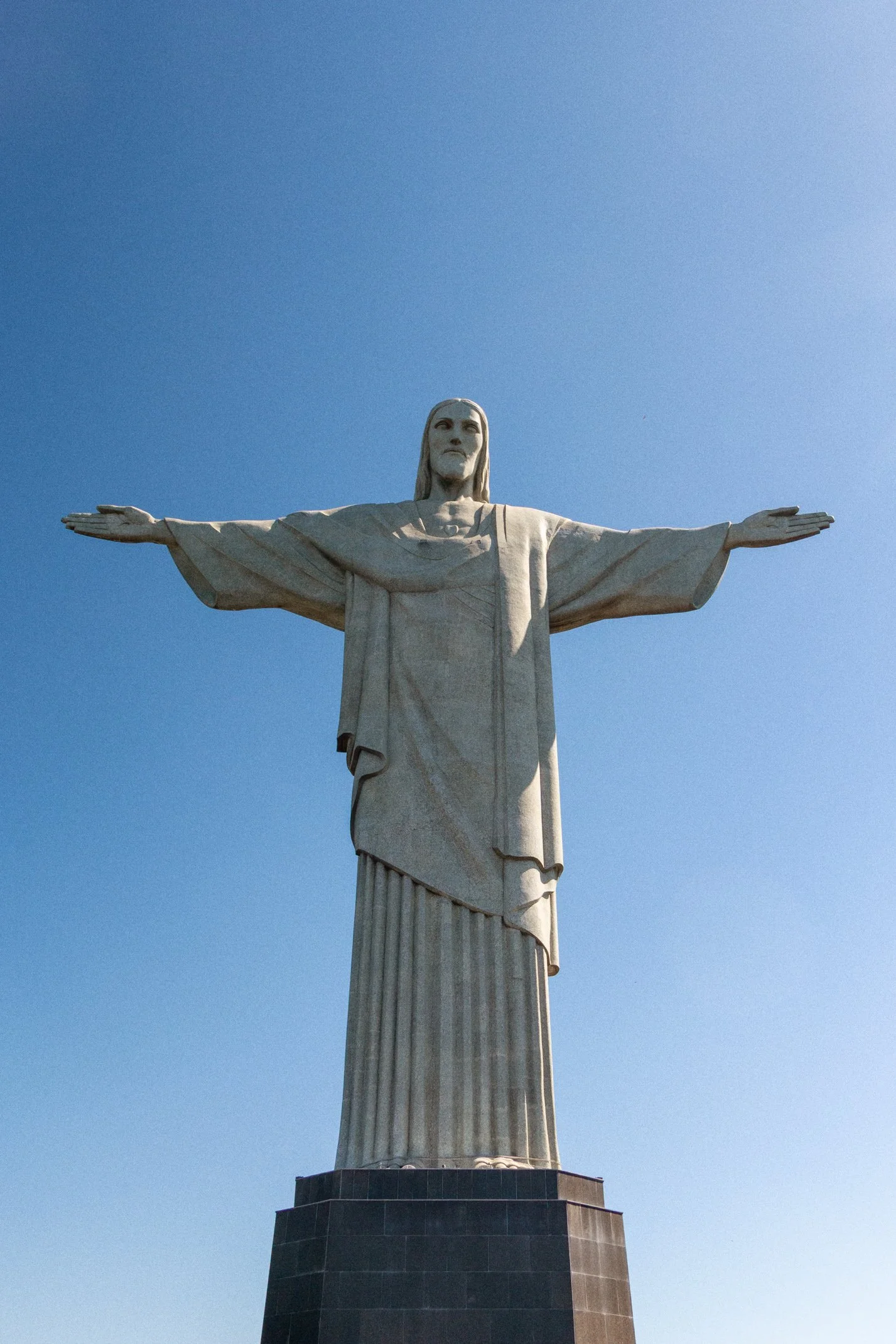
And then there is the statue itself, which is worth the moment of appreciation despite the crowds and the queue for the train. What surprised me most was the scale. At 30 metres tall on an eight metre pedestal, with a 28 metre arm span, it is smaller in person than the photographs prepare you for. Somehow that does not diminish it. It was finished in 1931, built from reinforced concrete and clad in thousands of small soapstone tiles, and the trick is that it is placed rather than sized. Look up from almost anywhere in the city and there it is, a pale figure on a distant ridge, tiny and unmistakeable.
Forte Duque de Caxias, the one I keep thinking about
This was the dark horse, and it ended up being my favourite spot in Rio.
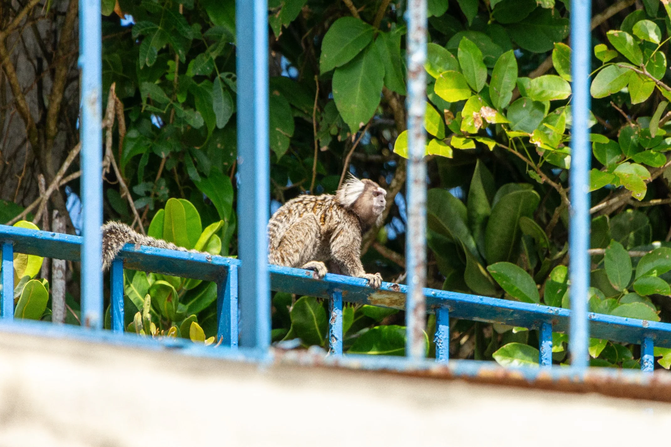
At the far end of Leme beach, past the last of the hotels, there is an entrance into a working Brazilian Army base. You pay a small fee in cash, walk through, and then climb an 800 metre cobbled service road up Morro do Leme through Atlantic rainforest. It takes about twenty minutes, it is properly steep in places, and it is thoroughly shaded. Marmosets appear in the branches along the way and they are entirely unbothered by you.
The fortifications at the top date to the late 1770s, built under Portuguese rule to cover the entrance to Guanabara Bay, and the site only took the name Duque de Caxias in 1935, after the patron of the Brazilian Army. Some of the old gun positions and platforms are still there to walk around and to my delight, is a relatively quiet area to visit.
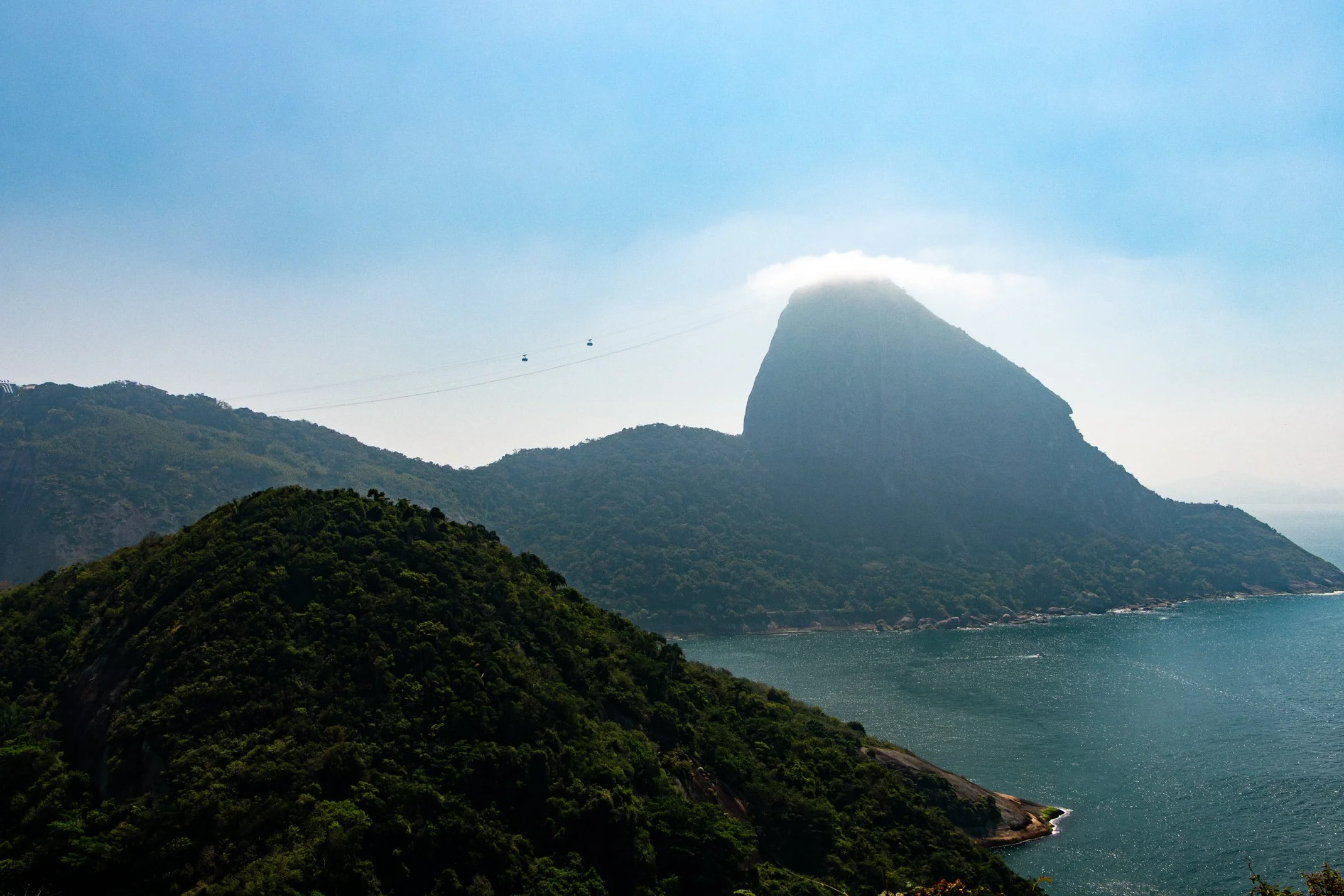
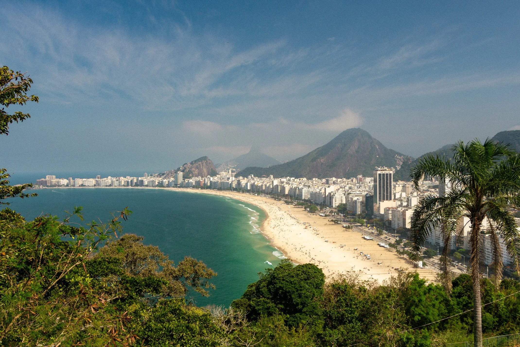
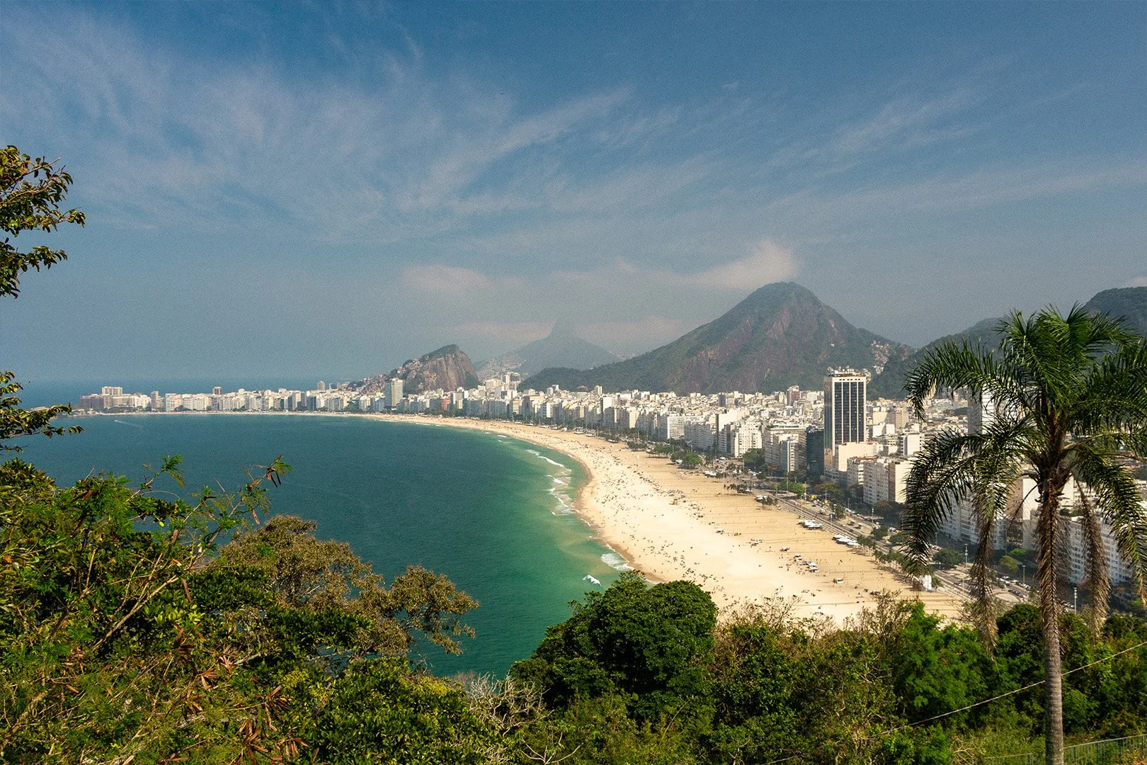
What you get from the top is Copacabana laid out below you in one clean curve, with Sugarloaf rising on the other side. It is the view people imagine when they imagine Rio, and I had it more or less to myself on a weekday morning.
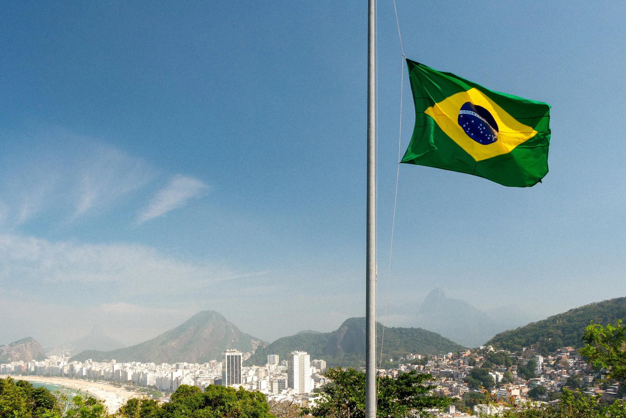
But the reason I keep coming back to this place is what happens when you pivot about 45 degrees to the right. There, filling the hillside directly behind you, is Morro da Babilônia, one of the two favelas that sit above Leme. It is not distant or discreet. It is right there, in the same field of view, close enough to see washing on lines and paint colours on individual houses.
The frame I came away with has Copacabana on one side, Babilônia on the other, and a Brazilian flag flying on the fort between them. It is the most complicated image I made on the whole trip, and the only one that felt like it was saying something about the city rather than simply describing it. Rio puts extreme wealth and serious hardship within a few hundred metres of each other, separated by nothing more than a slope and a road, and it is very easy to spend a week on the beach without ever properly registering that. Standing at the fort, you cannot not see it.
Four spots, and a list for next time
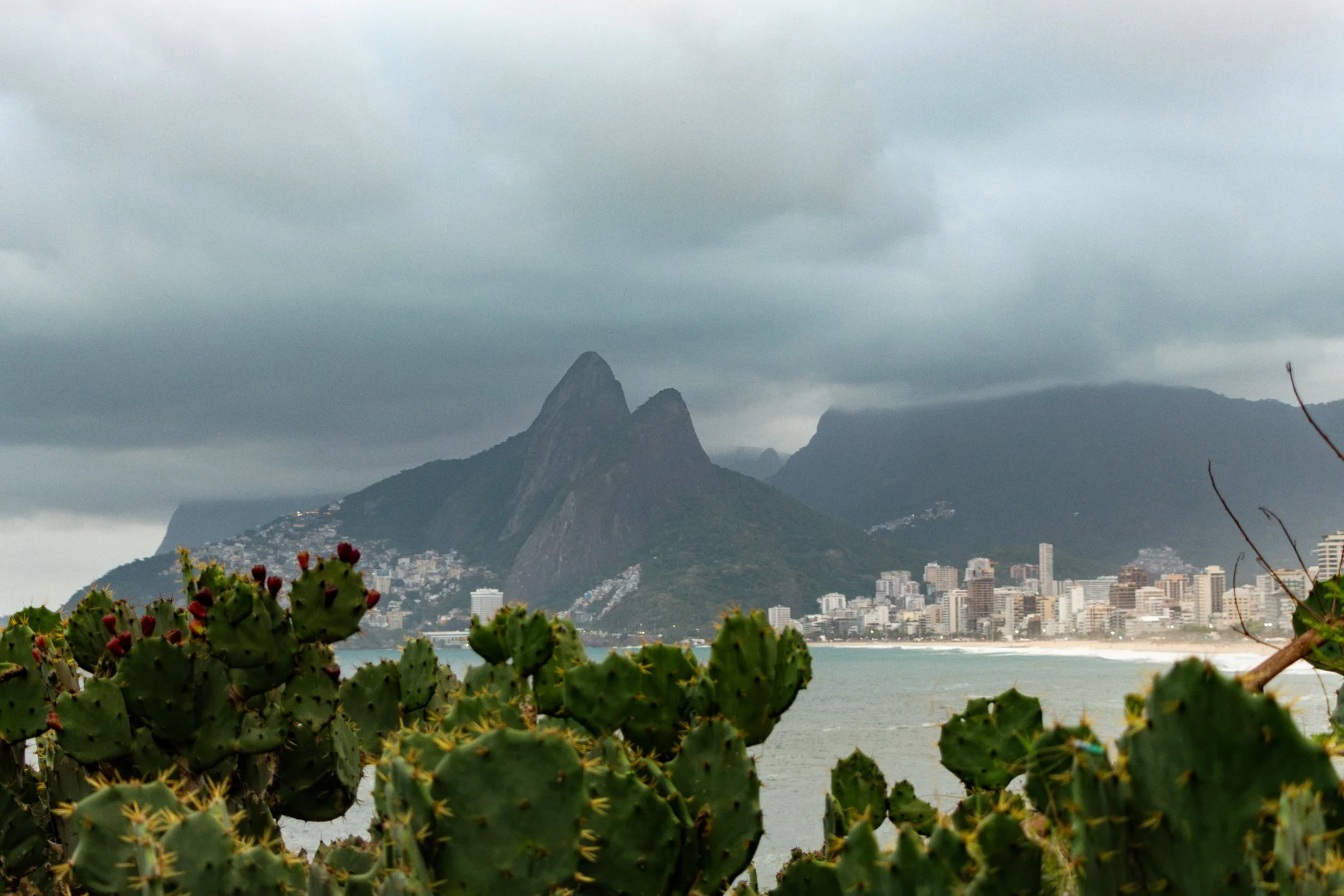
Rio is one of the most beautiful cities I have visited, and four locations barely scratches at it. There are plenty I did not reach such as Mirante Dona Marta, which produces the classic aerial postcard of Sugarloaf as well as Vista Chinesa, up in the forest. I did get to visit the Arpoador at the end of Ipanema, where the crowd applauds the sunset - but the weather was bad on the days I went and the sunset was merely just a time rather than a sight.
But if you are heading there with a camera and no idea where to start, these four cover it between them. The beach for texture and colour, Sugarloaf for the light, Corcovado for the geography, and the fort for the frame that actually makes you think.
Just hope the weather treats you as well as it treated me. August is winter in Rio, which sounds like a warning and is anything but. I was blessed with clear skies, mild air, and visibility right across the bay - except when I visited the Arpoador… but then again if you want to watch people clap for really odd things, just get on a Wizz Air flight to Spain and embrace the landing.
—
I photographed Rio de Janeiro in August 2026, from the sand at Copacabana to the top of an army base most visitors walk straight past. The full set, including the frame that started this whole question, is in my Brazil gallery.
If you enjoyed this story, you might like some of the other adventures I’ve shared:
Written by Max Biddlecombe following a visit to Rio de Janeiro in August 2026. Max is a UK-based travel photographer and writer who documents the world's overlooked places, from obscure territories and geopolitical curiosities to forgotten corners of famous cities.